The Demarcation Line: Route 66 and the Early 1960s
This is Part 2 of a three-part series on Route 66. Part 1, "Why Route 66 and the Mojave Captivate the World," asks why travelers cross oceans to stand on this road. Part 3, "The Mother Road," looks at it through the psychology of attachment.
I have come to think of Route 66 as a line drawn across time as much as across a map. On one side of it sits the postwar country most of us know mainly from photographs: black and white, chrome-bumpered, a little stiff in its Sunday clothes. On the other side sits the country we still live in, louder and freer and more divided, and broadcast in color. The old road belongs to the first country. The interstate that replaced it belongs to the second. And in the early 1960s, on a hundred acres east of Newberry, California, a widow with a typewriter was standing almost exactly on the line.
That is the argument of this piece, and I want to make it carefully, because a metaphor like "black and white" can flatten a whole generation if you are not careful with it. So let me start with machines and numbers, which are harder to romanticize.
The car comes home from the war
At the end of the Second World War there were about 25.8 million registered automobiles in the United States. By 1950 there were 40.3 million. By 1960 there were 61.7 million, and by 1970 there were 89.2 million. Those figures come from the Federal Highway Administration's long-run registration table, and they describe something close to a transformation of daily life. In twenty-five years the number of cars on American roads more than tripled.
A country that drives that much more needs different roads, and the politics of the era supplied them. On June 29, 1956, President Eisenhower signed the Federal-Aid Highway Act. The National Archives notes that it expanded the planned interstate system to 41,000 miles and authorized $25 billion for the fiscal years 1957 through 1969. Eisenhower's thinking went back a long way. As a young officer in 1919 he took part in the Army's first transcontinental motor convoy, and in the Second World War he saw what Germany's autobahns did for the movement of armies. The name the Archives files it under tells you what else was on the nation's mind: the National Interstate and Defense Highways Act. This was a Cold War road system as much as a commuter's convenience.
Route 66 had been built for an older idea of travel. The National Park Service describes it as a cobbling together of existing local, state, and national roads. It went through towns rather than around them. In the Mojave, as I wrote in Part 1, towns like Bagdad existed because steam engines and overheated cars needed water every few miles. It was a road made for the car of 1926, and for the driver who had to stop.
What it felt like to drive the old road
It helps to remember what that car was like, because the machine changed at the same speed as the country.
Start with the heat. Packard became the first automaker to offer air conditioning, as an option on its 1940 models, according to the history of automotive air conditioning. After that early experiment, and one by Cadillac in 1941, the idea went quiet. It came back for the 1953 model year, when the Chrysler Imperial offered Airtemp and Cadillac, Buick, and Oldsmobile added air conditioning as an option on some models. Even then it was rare. A trade report in Automotive Fleet counted factory air in 7 percent of new cars in 1960, 8 percent in 1961, and 12 percent in 1962. By 1969, 54 percent of domestic cars had it. In the space of one decade, crossing the Mojave in summer went from an ordeal you endured with the windows down to something you could do in a sealed, cooled room on wheels.
Steering came next. Chrysler put the first commercially available power steering on the 1951 Imperial and called it Hydraguide. It cost less than $200 as an option, and Cadillac followed in 1952. Power brakes had been invented decades earlier but did not become generally available as an option until the 1950s; by the 1954 model year Buick offered them as standard equipment on several of its cars.
The luxury cars got these things first. The family car took longer, and that lag is where you can watch the old country turn into the new. Curbside Classic compiled Chevrolet's own option figures for its full-size cars. In 1960, 27 percent of buyers ordered power steering, 11 percent ordered power brakes, and 3 percent ordered air conditioning. By 1970 the numbers were 95.2 percent, 60.5 percent, and 71.8 percent. Power brakes became standard on the big Chevrolet for 1971.
Put those figures beside the road and something clicks. The old two-lane highway, with its town every few miles and its gas station that was also a water stop, was made for a car you wrestled. You hauled on the wheel, stood on the brake, and rolled down the window and suffered. The interstate was made for a different machine: one that steered with a finger, stopped with a touch, and kept the desert outside the glass. The new car and the new road were designed for each other. Neither one needed Bagdad.
The year the picture changed
Now look at the country those cars were driving through.
The phrase "black and white" is more literal than it sounds. As late as 1964, only 3.1 percent of American television households had a color set. Then NBC announced that its prime-time schedule for the fall of 1965 would be almost entirely in color, and by the 1966–67 season all three networks were broadcasting full-color prime time. In 1972, for the first time, color sets outsold black-and-white ones, and more than half of American television households had color. For most of the people in this story, the television pictures of the 1950s were gray. The pictures of the late 1960s were not. The nation literally began to see itself in color in the same years the interstate was going in.
And look at what it was watching. On November 22, 1963, President John F. Kennedy was shot and killed in Dallas. Here is a detail I find hard to set down. Eight days earlier, on November 14, 1963, the national highway officials' association approved cutting U.S. 66 back from Santa Monica to Needles, according to the California highway history compiled at cahighways.org. The signs did not change for years. On paper, though, the Mother Road lost its California ending in the same month the country lost its president.
The war came in stages. On August 7, 1964, Congress passed the Gulf of Tonkin Resolution, which the State Department's historians describe as authorizing President Johnson to take any measures he believed were necessary to retaliate. In early 1965 the bombing campaign called Operation Rolling Thunder began, and Johnson authorized the first of many deployments of regular ground combat troops to Vietnam.
The position of women was shifting just as fast. Betty Friedan's The Feminine Mystique appeared in 1963. On June 10 of that year Kennedy signed the Equal Pay Act. On July 2, 1964, Johnson signed the Civil Rights Act, which barred discrimination in public places and made employment discrimination illegal. Its Title VII created the agency that enforces the ban on discrimination by sex as well as race. On June 30, 1966, a group of activists founded the National Organization for Women, Friedan among them.
I should be honest about the edge of the metaphor. The postwar years were black and white in more than one sense, and for many Americans they were not a gentle time at all. The motels and cafes that lined roads like 66 were exactly the kind of public places the Civil Rights Act of 1964 reached. The old order that faded with the road was not all innocence. Some of what faded deserved to.
But the larger point stands. Within roughly three years, from 1963 to 1966, the country lost a president, entered a war, began to rewrite the rules about women and race, and switched its screens to color. A society moving that fast wanted a faster road.
The interstate comes to the Mojave
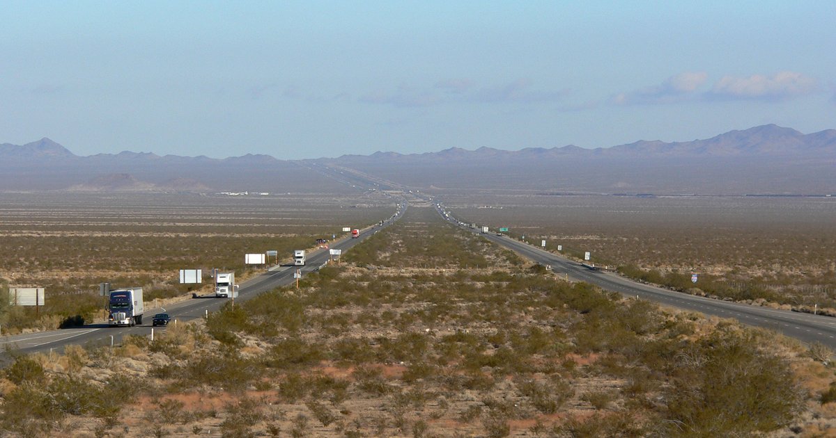
The interstate came to the desert east of Barstow in pieces. The highway history at cahighways.org, drawing on Tom Fearer's research for the Gribblenation blog, records that 32.8 miles of planned Interstate 40 between Newberry Springs and Ludlow were adopted in 1962, and that the interstate routing across the desert was adopted in January and February 1963. Funding for the Daggett-to-Ludlow segment was allocated in 1965. In the same years, the railroad, the Atomic Energy Commission, and California's public works department were studying a plan called Project CARRYALL, which would have used nuclear explosions to blast a new pass through the Bristol Mountains. Their feasibility study was published in November 1963. The state's highway division dropped out in September 1966, unwilling to wait any longer, and the pass was built the ordinary way. By 1969, maps showed I-40 finished from Barstow east to Ludlow. The last link, from Ludlow across the Bristol Mountains toward Needles, opened to traffic on April 13, 1973. U.S. 66 signs in California were cut back in 1972, and the remaining signage was removed in 1974.
Near Newberry the new road did not swing away into the distance the way it did past Ludlow. It ran close beside the old one. The book's site puts it plainly: "A freeway with controlled access is a wall as much as it is a road." For anyone whose land lay between the new lanes and the old highway, the worry was not that traffic would pass them by. It was whether they could still get out.
Even the town's name changed in those years. Newberry became Newberry Springs when its post office name changed in 1967.
Mrs. Orcutt herself
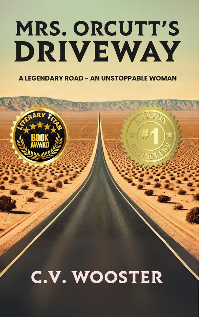
Mrs. Orcutt's Driveway, by C. V. Wooster.
Margaret Alberta "Bonnie" McMains Orcutt was born on September 7, 1909, in Boone County, Indiana. She grew up in Indianapolis, and in 1927 her family moved to Richmond, Indiana. She studied at Earlham College, Butler, DePauw, and the Arthur Jordan Conservatory of Music, and majored in biochemistry with a focus on plant biology. She was a concert-level harpist who performed with orchestras in New York. During the Second World War she taught pistol marksmanship to more than a hundred new police officers.
In 1948 she married Kenneth Forest Orcutt. Kenneth died in a plane crash. In April 1954 she faced a $50,000 lawsuit over that crash, and in September 1954 someone slashed the cover of her parked car. She left Manhattan Beach behind and chose 100 acres east of Newberry. Her first shelter there was an Airstream trailer, and she built an adobe house around it. A neighbor remembered her as "a tiny thing, probably four feet seven. A real pistol."
Around 1963, concrete survey markers appeared along her southern boundary, on a strip the book's site says the later letters describe as 300 feet wide and more than half a mile long. They crossed the dirt track that connected her house to old Route 66. She reached for her typewriter. On January 13, 1965, she wrote to Lady Bird Johnson and to President Lyndon B. Johnson. To the First Lady she wrote: "I only want what I have at present: a road on and one off of the present Highway (66)."
She died in 1986. The book places her headstone in Earlham Cemetery in Richmond, Indiana, back in the country she came from.
Every one of those facts comes from my book, Mrs. Orcutt's Driveway, and from the book's own site, where the trivia page sources each answer. The book is a historical narrative, and it says plainly that some conversations and characters are composites. What happened after she wrote to the White House is in the book, and I will leave it there.
What I want you to notice is where she stood. She was born in 1909, into the world of the harp and the Sunday letter. She was writing on a typewriter, by the light of the old America, to a president who had first taken office the day Kennedy died in Dallas. Her letter went out between the Gulf of Tonkin and Rolling Thunder, in the years when Friedan's book and the Equal Pay Act were telling American women they were allowed to want more. And here was a woman alone in the desert, asserting in writing that her claim to her own driveway mattered as much as the plans of the state. She did not ask to stop the interstate. She asked for access: one road on, one road off. In a sense she was asking the new country to leave a door open to the old one.
How the old ways faded
It would be easy to tell this as a story of villains, and I don't think it is one. The country did not abandon Route 66 out of spite. It outgrew the road. A nation with 89 million cars, a Cold War, cities sprawling into the desert, and families who now expected a cool cabin and a car that steered itself needed something faster and more connected than a chain of two-lane main streets. The interstate was the honest answer to that need. I drive it too.
But needs have costs, and the costs were paid in particular places by particular people. The road faded the way the black-and-white picture faded: not in a single day, but town by town and year by year, until one morning the old way of crossing the country was something you had to go looking for. Bonnie Orcutt was one of the people who stood at the edge of that change and refused to be erased by it.
That refusal raises a question the history alone cannot answer. Why does a road inspire that kind of loyalty? Why did people grieve for it, and why do strangers from other continents still feel they belong to it? That is a question about attachment, and it is where Part 3, "The Mother Road," begins. If you missed the opening of the series, Part 1 starts at a cafe in Newberry Springs.
This series draws on my book Mrs. Orcutt's Driveway, the true story of a woman who defended her driveway on old Route 66 east of Newberry when the interstate came through. It is also available on Kindle in French and Spanish. More Route 66 history lives on the book's companion site, mrsorcuttsdriveway.com.
Header image: Interstate 40 crossing the Fenner Valley in the Mojave Desert, California. Photo: Interstate 40 in Fenner Valley 1.jpg by Stan Shebs, CC BY-SA 3.0, via Wikimedia Commons.
